GPS or GLONASS: which car tracker to choose?
GPS-tracker is a special device, the purpose of which is to receive and transmit information about the movement of the vehicle. Among the advantages of such devices, it is possible to highlight the ease of installation, efficiency and unlimited range. To determine the location in such devices, special GPS and GLONASS satellite positioning systems are used. Many are interested in the question of how the system is more accurate, what are their differences and features, what to look for when choosing a tracking beacon. We will talk about this in this article.
Why do I need a car tracker?
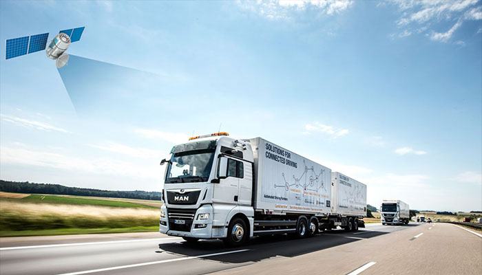
Using the tracker, the car owner can monitor in real time the current location of the car, check which route it is moving and control the speed. Due to the fact that the trackers are performed in a compact size, they are very easy to hide. For example, a beacon can be placed not only in the cabin, but also in wheel arches, bumpers, trunk and other places. Some models are manufactured in durable sealed enclosures, are not afraid of dampness and can be used in extreme weather conditions. They can be installed on motorcycles, ATVs, boats and other vehicles.
Most often, GPS trackers are used for integrated monitoring of cargo transportation. With their help, transport companies and logistics departments of large enterprises can constantly monitor the movement of goods, monitor fuel consumption and drivers.
The main task that can be solved using tracking devices is protection against the actions of hijackers. Many models are reliably protected from the influence of "jammers" used by criminals. They will also help to quickly find a car, if the theft still happened-just turn on a special application, and you can quickly determine the location of the stolen vehicle. You can also get information about the coordinates of the machine via SMS. Some models of car trackers allow you to remotely control a car, for example, turn off the engine in case of theft.
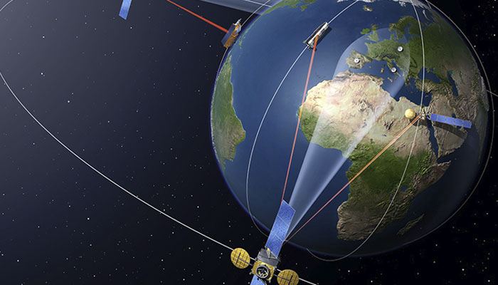
The most famous and popular satellite positioning systems are GLONASS and GPS. With their help, you can determine the coordinates of the object with an accuracy of 2.5 m. In addition, there are GSM positioning systems (LBS), which can also allow you to determine the coordinates of the machine, but their accuracy is noticeably worse. In this case, the coordinates are determined using the base stations of the mobile operator through which the device is currently transmitting data. The accuracy is low, because one such station covers an area of about 300-800 meters in the city, and up to 10 km outside the city limits. LBS positioning is usually used only in cases where the satellite signal is unavailable.
How does the GPS/GLONASS tracker work?
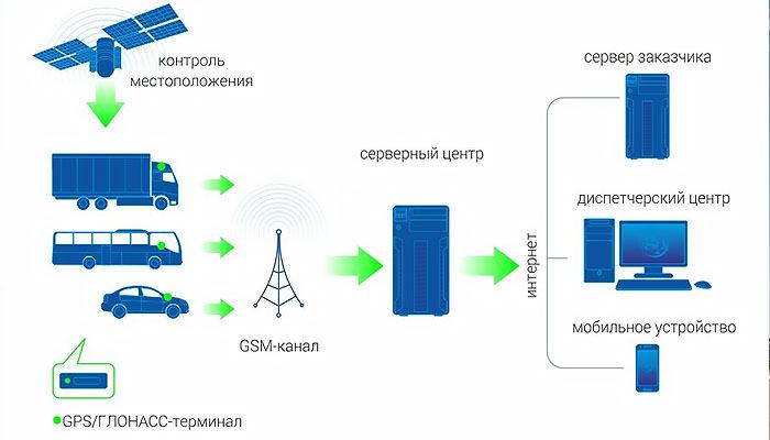
Any tracker consists of several basic elements, each of which has its own functions:
- Satellite signal receiver (GPS/GLONASS), it is he who allows you to determine the coordinates of the device, and hence the object being monitored.
- GSM-module-with its help data is transferred to a special telematic server or phone of the owner of the machine.
- Built-in and/or external antenna, used to receive a signal, the type of antenna may be different depending on the design of a particular device.
- Battery. The battery life of the device depends on the battery capacity, as a rule, in the beacon mode, the energy consumption is minimal, so the device can work for a year or more without recharging. Some models have the ability to connect to the vehicle’s on-board network, this is necessary if the device transmits data constantly with high frequency.
- Internal memory that allows you to store important data, such as route information and coordinates.
To monitor the object, a special software is used.sintering, which is installed on the server of the manufacturer of the tracker or on independent servers of companies specializing in the provision of vehicle monitoring services. The data exchange between the tracking device and the server is performed in the form of information "packets"-this is a set of data collected by the tracker about coordinates, time, speed, etc., which are packaged in a certain way and then transmitted to the server using a special protocol. The end user receives this information in the most convenient form for him through the web interface, mobile application, etc.
It is also worth considering that even two devices equipped with the same monitoring system can demonstrate different accuracy in determining the coordinates of an object. This is due to the technical characteristics of the devices themselves. Some, for example, have a shielding function, while others do not. In addition, the accuracy of signal reception and transmission may depend on the type of antenna used. All this must be considered when choosing a device.
GPS or GLONASS?
Naturally, before you buy a tracker for a car, you need to decide for yourself which satellite positioning system is needed, it is important to choose GPS or GLONASS in advance. Each of them has certain advantages and disadvantages. Let's take a closer look at the features of each system.
GPS
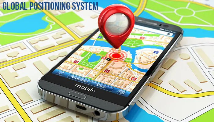
GPS (Global Positioning System)-it appeared almost 50 years ago, it was specially developed for the needs of the US Department of Defense. That is why for a very long time the system was used exclusively for military needs, now it is widely used for peaceful purposes. The first satellite was put into orbit in the distant 1974.
A feature of the system is that GPS satellites move in 6 planes (4 satellites per plane). The signal is very accurate, and the system itself can provide a quick response. The accuracy of GPS trackers is very low-no more than 2-4 m.
The advantages of GPS positioning technology include compact receiver dimensions, maximum coverage, and the ability to measure the speed of an object. However, there are certain disadvantages-sensitivity to the effects of jammers, as well as instability of signal transmission in underground parking lots, in tunnels, under bridges, etc.
GLONASS
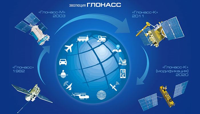
GLONASS (Global Navigation Satellite System)-this system hails from the USSR, the first developments began back in the 50s of the 20th century. Like GPS, development was commissioned by the Ministry of Defense of the Soviet Union. However, the first satellite was launched only in 1982. Now the system includes 24 satellites that move in 3 planes (8 satellites per plane). The peculiarity of this system is that the trajectory of the satellites is not synchronized with the motion of the Earth, which does not require constant adjustment of their motion and increases the stability of their work. This system has a fairly high degree of security and provides a stable signal that is not sensitive to the effects of jammers.
The main disadvantages of GLONASS are the fewer satellites (and therefore the coverage area), as well as a longer signal processing period than a competing system. The error in determining the coordinates of the object is up to 3-6 meters.
Complete solution
Many manufacturers now offer trackers equipped simultaneously with two tracking systems and GLONASS, and GPS. Such devices not only allow maximum tracking accuracy of vehicles, but also contribute to increased signal protection. In addition, due to the combination of two modules at once in one device, it is possible to achieve the maximum accuracy of determining the coordinates of the object-in such trackers, the positioning error usually does not exceed 1.5-3 m. Moreover, the price difference is usually not very large, but you will get maximum coverage and a stable signal from satellites of two systems at once. This virtually eliminates dead spots and improves monitoring efficiency.
If you want to buy a GPS-tracker for a car in Kiev, Kharkov or Odessa, then in our store 130.com.ua you will find a large selection of devices from manufacturers. All trackers and beacons presented in the catalog have a guarantee and are distinguished by long and stable operation.
Related materials
GPS trackers: Best Sellers

Stay tuned for updates!
Subscribe to our Telegram channel and be the first to receive useful materials.
Subscribe


